DKW 1800 series
In-app purchases
5K+
Downloads

Everyone
info


About this app
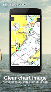
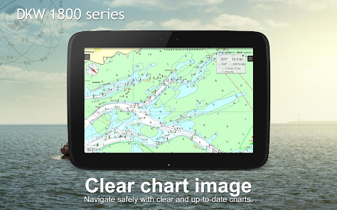
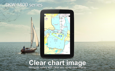
Navigation app with digital nautical charts for boaters and commercial shipping.
This app can be used as a substitute for the 1800 series paper charts of the Dutch Hydrographic Office. The DKW 1800 series are a set of digital nautical charts of the Dutch coastal waters, based on 1800 series charts from the Dutch Hydrografic Office, including weekly updates of the 'Berichten aan Zeevarenden' (BaZ) and extra depth information from the 'Wadvaarders'.
Note: You can purchase the charts in the app individually or as a package.
To get the most of these charts, we recommend that you use our app WinGPS Marine. This will make your Android device a complete and safe navigation system. Take a look on www.wingpsmarine.com for more information.
Coverage of the complete 1800 serie is :
1801: Noordzeekust: the Panne to Den Helder.
1803: Westerschelde: Vlissingen to Antwerp.
1805: Oosterschelde, with Veerse Meer and Grevelingenmeer.
1807: Zoommeer, Volkerak and Spui, Haringvliet and Hollandsch Diep.
1810: IJsselmeer, Markermeer, Randmeren and North Sea channel.
1811: Waddenzee West and surrounding North Sea coast.
1812: Waddenzee East and surrounding North Sea coast.
What can you do with this app?
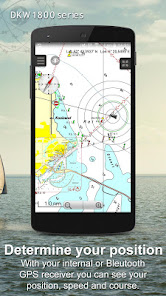
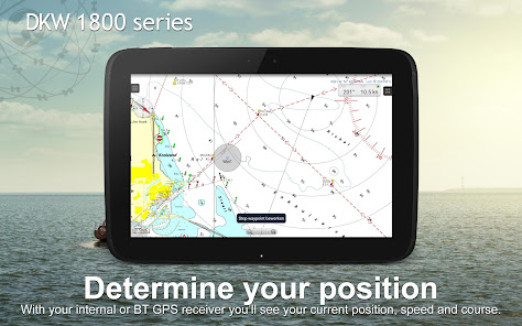
• Show current or last know location on the chart and set follow mode to automatic.
• Show your track.
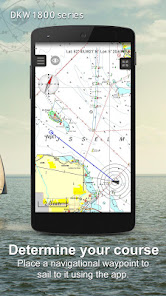
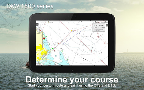
• Create your own waypoints and navigate to them.
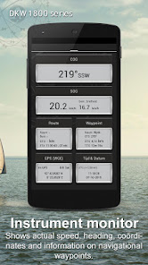
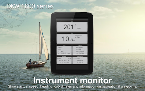
• Instrument monitor shows you: course over ground (COG), speed over ground (SOG) and latitude & longitude (Lat&Lon) of your GPS. Also the course to steer (CTS), distance to go (DTG), time to go (TTG) and the estimated time of arrival (ETA) of your selected waypoint will be showed.
• Updates will be checked automatically when you start the app.
Why use this app?
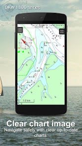
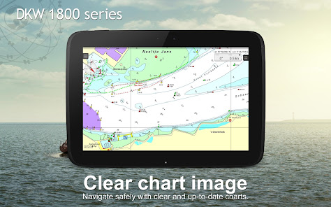
• Weekly BaZ update service on your charts. Stentec guaranties the most up-to-date charts for maximum safety.
• The Waddenzee charts 1811 and 1812 also come with the current depth information provided by ‘Rijkswaterstaat’.
• Sign in with your Stentec account and also use this chart on your Windows laptop using WinGPS navigation software. Take a look on www.stentec.com for more information.
This app can be used as a substitute for the 1800 series paper charts of the Dutch Hydrographic Office. The DKW 1800 series are a set of digital nautical charts of the Dutch coastal waters, based on 1800 series charts from the Dutch Hydrografic Office, including weekly updates of the 'Berichten aan Zeevarenden' (BaZ) and extra depth information from the 'Wadvaarders'.
Note: You can purchase the charts in the app individually or as a package.
To get the most of these charts, we recommend that you use our app WinGPS Marine. This will make your Android device a complete and safe navigation system. Take a look on www.wingpsmarine.com for more information.
Coverage of the complete 1800 serie is :
1801: Noordzeekust: the Panne to Den Helder.
1803: Westerschelde: Vlissingen to Antwerp.
1805: Oosterschelde, with Veerse Meer and Grevelingenmeer.
1807: Zoommeer, Volkerak and Spui, Haringvliet and Hollandsch Diep.
1810: IJsselmeer, Markermeer, Randmeren and North Sea channel.
1811: Waddenzee West and surrounding North Sea coast.
1812: Waddenzee East and surrounding North Sea coast.
What can you do with this app?
• Show current or last know location on the chart and set follow mode to automatic.
• Show your track.
• Create your own waypoints and navigate to them.
• Instrument monitor shows you: course over ground (COG), speed over ground (SOG) and latitude & longitude (Lat&Lon) of your GPS. Also the course to steer (CTS), distance to go (DTG), time to go (TTG) and the estimated time of arrival (ETA) of your selected waypoint will be showed.
• Updates will be checked automatically when you start the app.
Why use this app?
• Weekly BaZ update service on your charts. Stentec guaranties the most up-to-date charts for maximum safety.
• The Waddenzee charts 1811 and 1812 also come with the current depth information provided by ‘Rijkswaterstaat’.
• Sign in with your Stentec account and also use this chart on your Windows laptop using WinGPS navigation software. Take a look on www.stentec.com for more information.
Updated on
Safety starts with understanding how developers collect and share your data. Data privacy and security practices may vary based on your use, region, and age. The developer provided this information and may update it over time.

No data shared with third parties
Learn more about how developers declare sharing

This app may collect these data types
Personal info

Data isn’t encrypted

You can request that data be deleted
What's new
- 2024 edition charts available.
- Support for Android 14.
- Various other updates.
- Support for Android 14.
- Various other updates.


